GPS & Map Toolbox is a navigation app developed by Audama Software. Available for $1.99, it was updated to v3.00 on September 28, 2017, and currently holds a 3.31 out of 5 rating based on 13 reviews. Before downloading, make sure your device has at least 27 MB of free space and runs Android 7+ or iOS 8.0+.
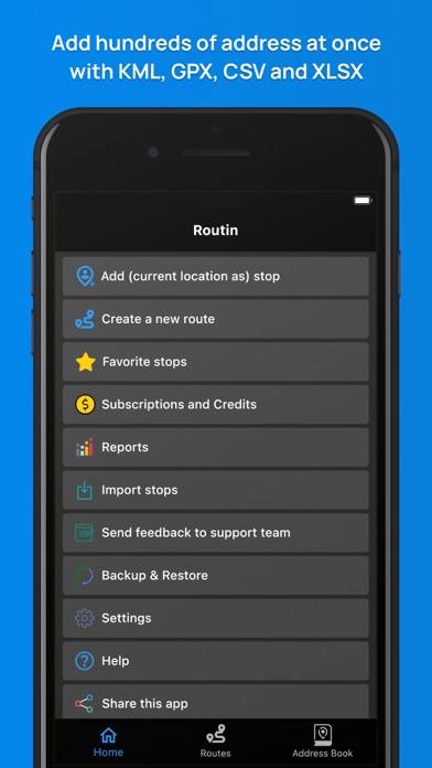
Multipurpose GPS database tool
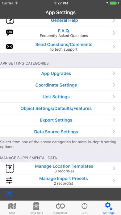
Description
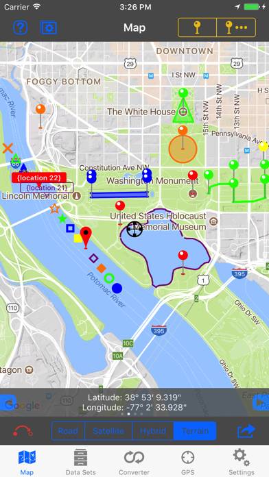
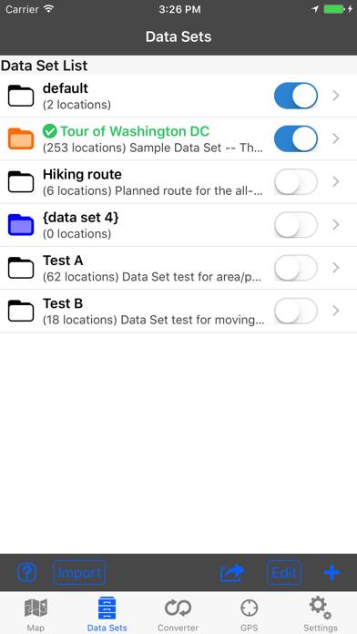
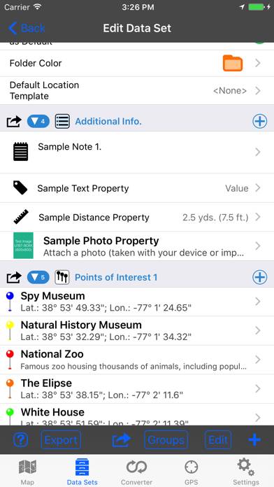
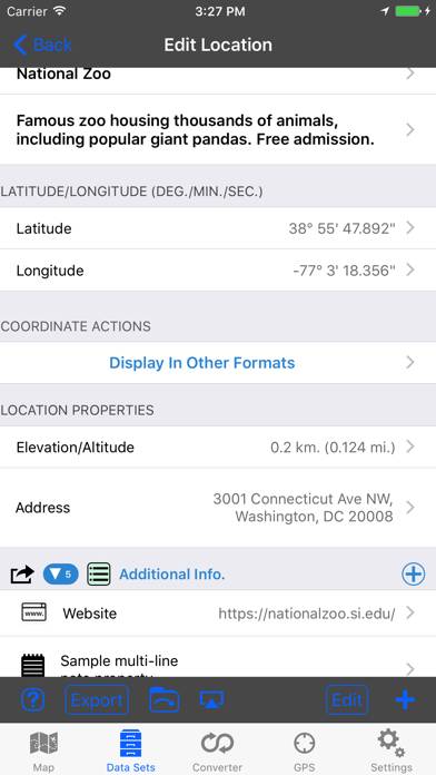
◦ This is the ultimate GPS location database tool designed to save, organize, share, display, import, export, and analyze location records and their properties.
Show more
User Reviews and Ratings
★★★★★ AwesomeI work for a Fire Rescue department, and use this app to log hydrant and building locations within my jurisdiction. It is an amazing tool, allowing myself and crews to make critical response decisions en route to calls. It also utilizes USNG for land navigation as an option, which is the nav system we use. The app allows me to quickly see the building I am going to, the nearest hydrants, satellite view of terrain and objects, utility shutoff points, and with the touch of a button go to google
★★★★☆ Bookmarks for Offline UseNeed user-friendly way to create KMZ files to use in the offline app MAPS.ME. This is necessary because if its limited search capability. Need the offline app feature because I’ll be traveling in EU with no data service on my iPhone. In this way, GPS Toolbox serves as an excellent trip planning tool. Works great now that I figured out the user instructions are located in “Settings/Help”
5 star SUGGESTION: provide a link to a downloadable pdf file for HELP information ~ perhaps you could
★★☆☆☆ Not for KML or KMZI should have read deeper in, but assumed it would display maps in KML format. I was planning on hiking and found a trail map for importing. So was disappointed when it could not. I found "KML KMZ GPS” did the job.
★★★★☆ Excellent, But....I got this app right after it came out, and have loved it ever since. But....!
Why can't the satellite maps be updated?
I have new facilities in my fire response area that aren't on the maps, but are on other mapping programs.
I have Blue Pins designating structures, that are sitting in the middle of large grassy fields.
If at all possible, please update the maps!
Thank you!!!
★★★★☆ Very useful, too bad it locks upPerfect for my use, determining a 200 foot radius circle around structures for brush clearance (fire insurance requirement). Put a pin on the structure, set the radius, then walk around the edge of the circle staking it out. I'd give it 5 stars but it has locked up a few times in the couple of days I've been using it. That's a nuisance, but the app still gets the job done.
Read all reviews