Hiking Maps - PeakVisor is a travel app developed by Routes Software SRL. Available as a free download, it was updated to v5.24 on September 21, 2024, and currently holds a 4.58 out of 5 rating based on 11.2K reviews. Before downloading, make sure your device has at least 126 MB of free space and runs Android 12+ or iOS 13.0+.
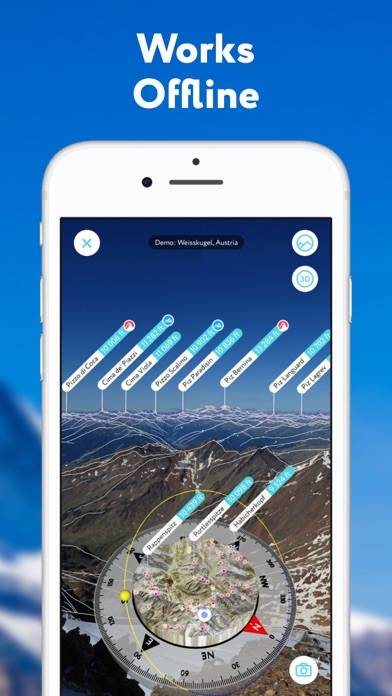
Peak Finder with 3D Maps
Video: Hiking Maps Overview
Description
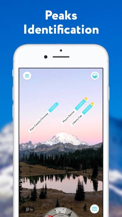
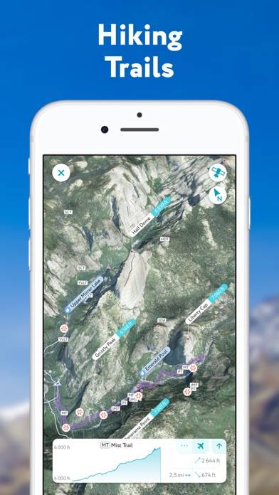
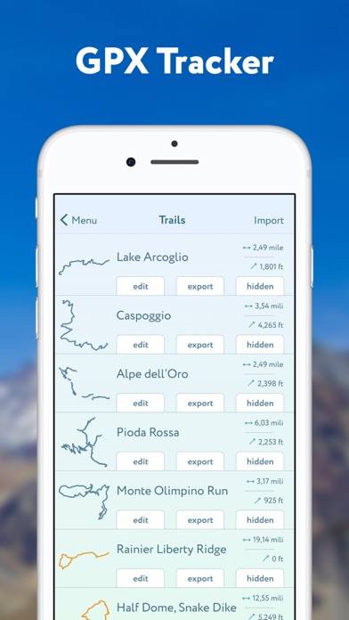
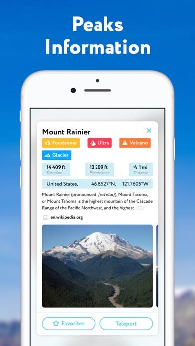
PeakVisor will make you a champion of mountain navigation, putting state-of-the-art Peak Identification, 3D Maps, Trails, and outdoor GPS tracking into the palm of your hand.
Hiking Maps - PeakVisor can be played on Windows and macOS using Android emulators such as BlueStacks. Download an APK version and follow our BlueStacks installation guide to get started. For help with downloading or installing APK files, visit our forums.
User Reviews and Ratings
★★★★★3D Mapping at its best
Have been playing with the app for a few years. The free version tickled my curiosities about the scenery around me. I really started using the app when the 3D Mapping became awesome. I purchased a "lifetime" membership because I like to know where I am when snowmobiling. The ability to import .gpx files from Garmin Eathmate, COTrex, etc into PeakVison is incredible. I can now see 3D maps of my sled rides, ski day, raft trip, mountain bike ride, etc.
★★★★★It’s a cool app!
This app is really useful, not only when hiking up in the mountains but also when just driving around. It labels the mountains wherever we are, even above the cloud. It’s a really cool app.
★★★★★Amazing!
It is easy to use and really fun!
★★★★★Fantastic App for Outdoors
I purchased the lifetime subscription over a year ago and have since gone to hikes in the US, Norway, Sweden and Brazil. Last year I went on a two day trip over the mountains in Norway and we had our outpost with tent set up for the night. We then went out on a 6 hour excursion on foot over ice and harsh terrain. By the time we started to head back, it was already too dark to see the trail markings. Luckily, I had tracked the entire route from the tent, so we were able to return swiftly with no
★★★★★Just right
This is the best functioning AR peak/summit app as far as reliability and horizon accuracy. It also has a great suite of navigation and history keeping features; being able to plan routes, save your tracks and trips, and leave reviews and check ins all works well together.