I-Boating: USA Marine Charts is a navigation app developed by Bist LLC. The last update, v107.00, released on May 27, 2021, and it’s rated 4.31 out of 5 based on the latest 173 reviews. I-Boating: USA Marine Charts costs $23.99 and requires iOS 8.0+ and Android 7 or newer to download.
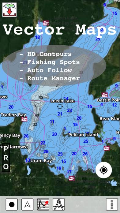
Nautical + Lake Contour Maps
Video: I-Boating: USA Marine Charts Overview
Description
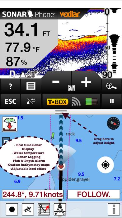
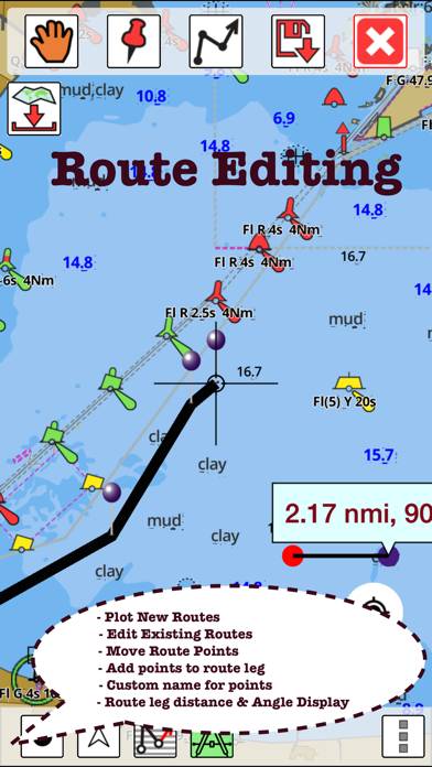
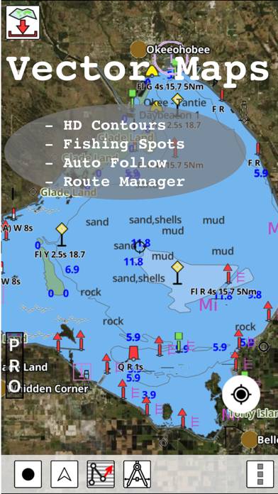
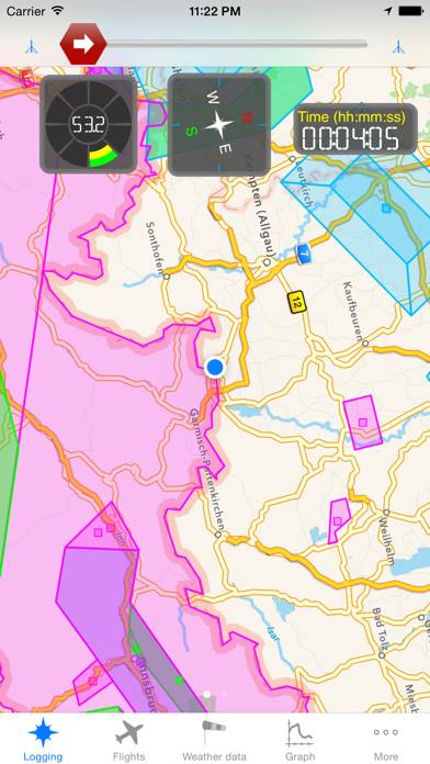
This App offers access to NOAA marine vector charts, freshwater lake maps, USACE inland river maps (HD/1ft/3ft bathymetry included where available).
How to Use I-Boating: USA Marine Charts on Your PC or Mac
Want to enjoy I-Boating: USA Marine Charts on your desktop? Download the latest APK (107.00, 61 MB) or choose your preferred version, and follow our Bluestacks emulator guide for easy installation on Windows or macOS. For any assistance with downloading or installing APK files, feel free to visit our forums!
User Reviews and Ratings
★★★★★Worked perfect for me
We are avid boaters in Texas and like to try out new lakes. Downloaded the app and headed to Lake Texoma. Huge lake and we didn’t want to get lost or bottom out on a low spot. I ran the app concurrently with my Lowrance and the app was actually better because I could see how the under water terrain changed and could navigate around the low spots through the channels. I was able to set waypoints on fishing hotspots, etc. Just as described.
★★★★☆Decent app
App works most of the time. Great when it does. They still need to add Lake of the Woods and other lakes in northern Minnesota and Canada.
★★★★★Amazing app!
Just getting acquainted with this app, and I can’t compare it to other similar ones, but wow, it sure does work. 20$ for all of North America and no other costs. Works great.
★★★★★Great app
The charts are exceptional and the depth indications are great for fishing on Lake Michigan and navigating the St. Joseph river.
★★★★★Excellent small boat charting option!
Moved recently from Florida to Utah. Have encountered a number of nautical challenges transitioning from coastal chart plotter navigation to inland lakes navigation. Garmin & Lowrance both want a fortune for their chart plotter options in both inland and coastal products. This i-boating USA app. Provides fabulous detail on both coastal and inland options for a very, very reasonable price point. Awesome option alternative to big boy price gouging for marine navigation.