ISailGPS : NOAA USA RNC Charts is a navigation app developed by James Associates. The last update, v9.40, released on September 18, 2024, and it’s rated 3.87 out of 5 based on the latest 67 reviews. ISailGPS : NOAA USA RNC Charts costs $7.99 and requires iOS 12.0+ and Android 11 or newer to download.
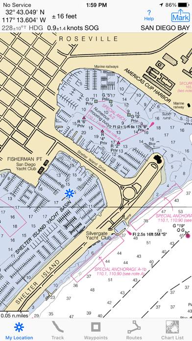
Marine Nautical Chart Plotter
Description
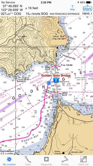
Unleash the navigation potential of your iPhone or iPad with SailGPS! Turn your device into a high-performance GPS receiver with USA NOAA Raster Nautical Charts, even without a cell signal!
How to Use ISailGPS : NOAA USA RNC Charts on Your PC or Mac
Want to enjoy ISailGPS : NOAA USA RNC Charts on your desktop? Download the latest APK (9.40, 10 MB) or choose your preferred version, and follow our Bluestacks emulator guide for easy installation on Windows or macOS. For any assistance with downloading or installing APK files, feel free to visit our forums!
User Reviews and Ratings
★★★★★iSail GPS
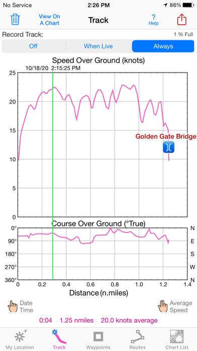
Replaces a basic chart plotter. I run in the dark quite a bit, and this app has been very accurate for me.
I’m always impressed - basic functions, but it performs very well.
★★★★★Great Chart Plotter!
Any of the negative reviews, and there are only a few, cleary just downloaded the app and didn’t bother to learn it. This app is amazing! I do wish I could figure out how to download additional waypoint icons though. Anchorage, bouy, ramp, hoist, pump out, etc. it may be possible but I can’t figure out. Still tho, great map. One tip, when creating waypoints, make sure to use in insets or zoom way in because, initially, when I was creating them, I learned that they were way off!
★★★★★Great Little App
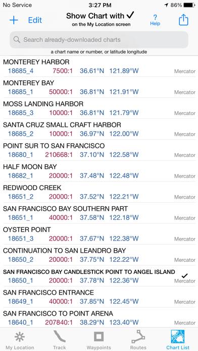
I just wanted an app that I could use for viewing NOAA raster charts. This does the job plus so much more. I like that you can download the charts right to your phone so they are always available whether you have cell phone service or not. The app itself doesn’t take up much space on your phone which is another plus. For under $10 you can’t go wrong with this app folks.
★★★★★Great app!
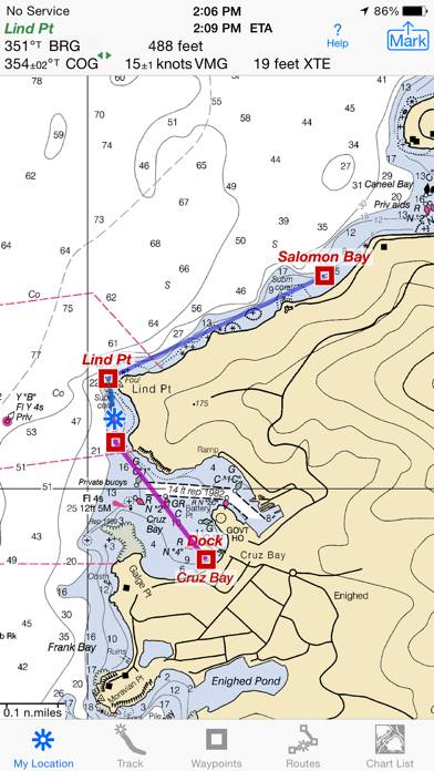
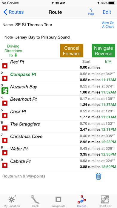
I love this app! It gives me exactly the info I need when racing or just sailing. I’ve set waypoints for all the government and private buoys we use to set our race course. Then all I have to do is create a route by choosing the waypoints to be used for that day’s race. Then I have SOG and bearing and VMG to each mark and more. Amazing! The learning curve is a bit steep, but well worth it. And if I have questions, the developer is super-quick to respond. Highly recommended.
★★★★★Can’t beat it
I have used this app on my phone to navigate my sailboat at night from San Diego to Catalina and arrived at Avalon dead on the mark and within five minutes of the predicted ETA. While it’s less convenient than a dedicated chart plotter, it gets the job for a fraction of the price.