LidarCad
Published by Svetlana Sandalova on Jan 12, 2019Genre: Productivity
Ratings: 2.71
Version: 1.9.10
Updated: Aug 30, 2022
Downloads: 504
LidarCad is a productivity app developed by Svetlana Sandalova. Available for $17.99, it was updated to v1.90 on August 30, 2022, and currently holds a 2.71 out of 5 rating based on 7 reviews. Before downloading, make sure your device has at least 62 MB of free space and runs Android 13+ or iOS 14.0+.
Professional Cad Solution
Description
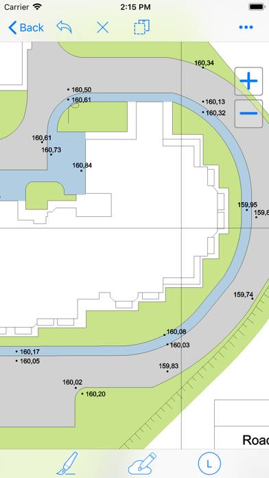
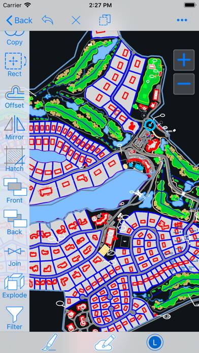
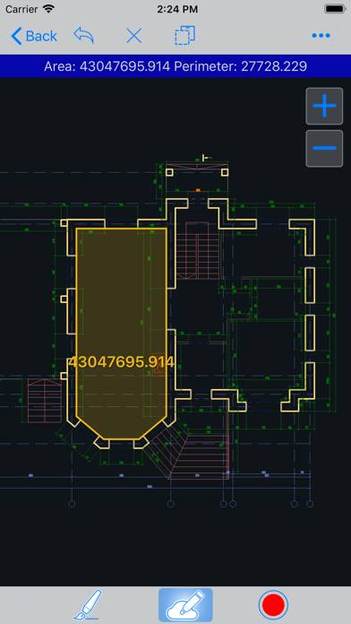
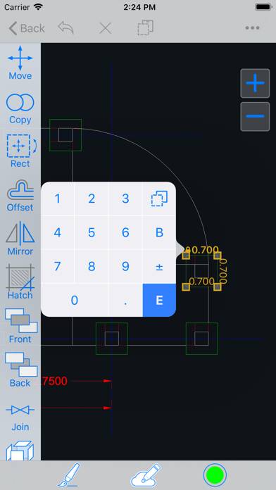
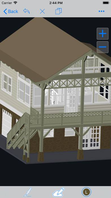
LidarCad combines CAD Editor and LiDAR Scanner into one Application. With LidarCad it is easy to estimate volumes of sand or gravel, capture point clouds, measure length, area and so on.
Show more
Download LidarCad
Scan to Get the App!

Using LidarCad on PC or Mac
LidarCad can be played on Windows and macOS using Android emulators such as BlueStacks. Download an APK version and follow our BlueStacks installation guide to get started. For help with downloading or installing APK files, visit our forums.
User Reviews and Ratings
★★★★★ Great tool for underground mining and construction!
Love this app, use it all time at the underground mine I work at. I was able to scan 300 ft of tunnel and match it with a survey scan. Perfect for scanning cross sections for ventilation stations and measuring distances. I can easily use the data in Maptek Point Studio and Trimble business center. Only complaint is that I can not export my scans as a las file I have to convert the pts file in Trimble in order to use it in Point Studio. So 6 ****** stars if you can add a las as export option.
★★★★★ Good
I use this app to view drawings.
★★★★★ Great updates
Read all reviews
I can now apply field codes to points as I create them. Several survey applications where this level of accuracy is acceptable. Great tool. Thank you for the amazing app!
Similar Productivity Apps

Simple Days Counter
SaiSuke

WiFi Camera for OBS
VPN Snake super turbo service
Obsidian - Connected Notes
Big Keys Keyboard