MapPath Pro
Published by Julien Roze on Mar 27, 2012Genre: Navigation
Ratings: 4.25
Version: 8.1
Updated: Sep 14, 2024
Downloads: 782
MapPath Pro is a navigation app developed by Julien Rozé. Available for $2.99, it was updated to v8.10 on September 14, 2024, and currently holds a 4.25 out of 5 rating based on 4 reviews. Before downloading, make sure your device has at least 7 MB of free space and runs Android 12+ or iOS 13.0+.
GPS Tracker, Map Measure Tool
Description
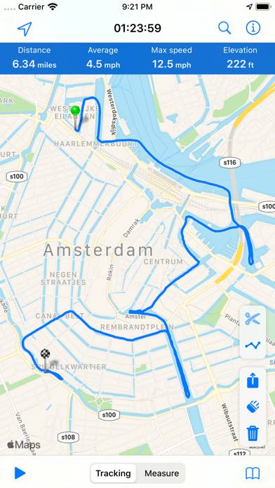
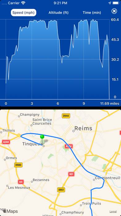
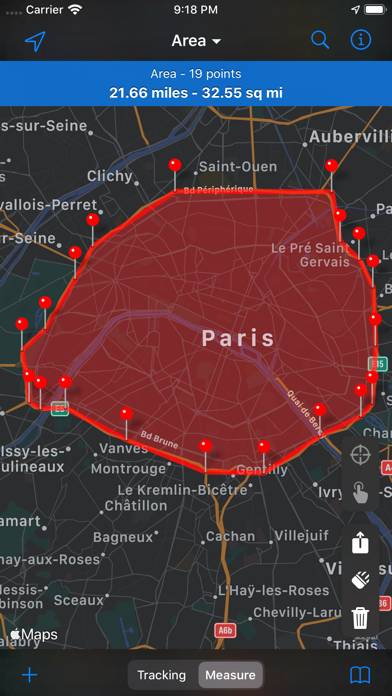
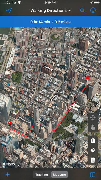
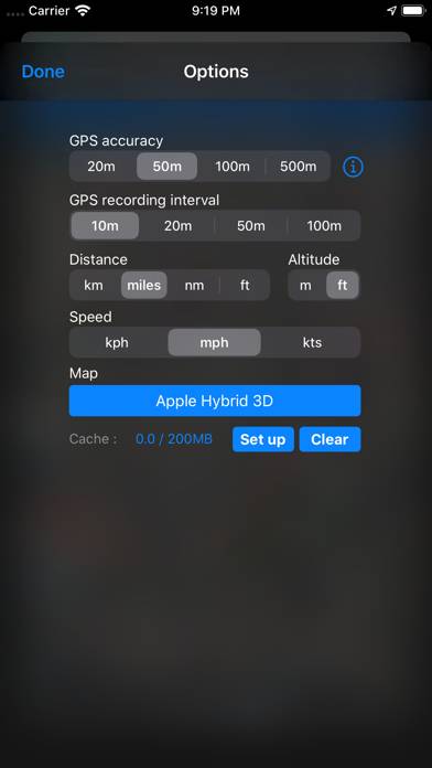
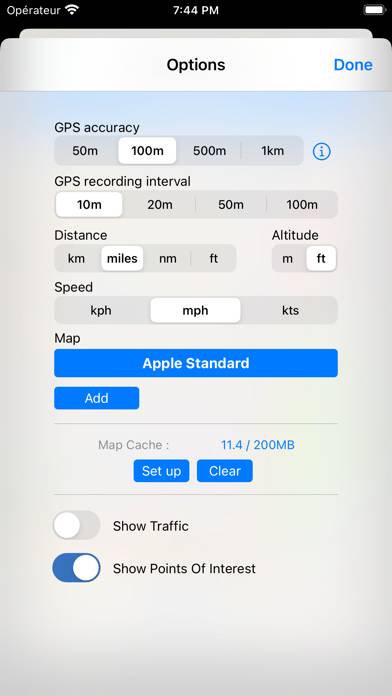
MapPath is an easy-to-use app allowing you to record your trips. It displays your track, your position and live information such as your speed, altitude and average speed/pace.
Show more
Download MapPath Pro
Scan to Get the App!

Using MapPath Pro on PC or Mac
MapPath Pro can be played on Windows and macOS using Android emulators such as BlueStacks. Download an APK version and follow our BlueStacks installation guide to get started. For help with downloading or installing APK files, visit our forums.
User Reviews and Ratings
★★★★★ Very stable!
Works great. Very useful app!
★★★☆☆ Works Well ... When It Works
This app can track your progress very precisely, and is a great way to record the particulars of vacation travel. Except on two occasions when I activated tracking at the beginning of the day, only to find that my route had not been recorded when I stopped for the evening. VERY frustrating. The developers need to make this more reliable before it will become a real asset for travelers.
★★★★☆ Need options for pinpoints
As a delivery driver this could be so
Much better if we had an eraser tool and the ability to put pinpoints in multiple locations and to label them.
★★★★★ Great App!
Absolutely perfect for what I was looking for — a way to show a KML file on my iPad. Thanks for a great app...
★★★★★ Works as advertised.
Read all reviews
Works as advertised. I needed the ability to create perfectly circular shape files (not polygons) with a user definable radius and export them to other GIS software via KML. MapPath does this very well. Thank you.
Similar Navigation Apps
Routin Route Planner
SledNH 2024
Top #81 in Navigation Apps
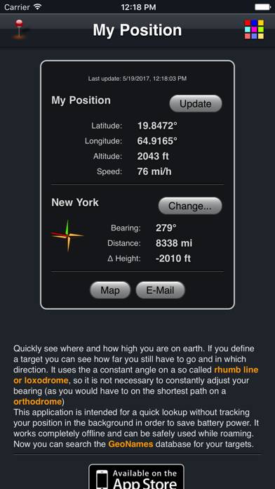
My Position App
Top #86 in Navigation Apps

Ohio Mushroom Forager Map!
Top #92 in Navigation Apps
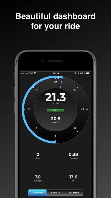
M365 Plus
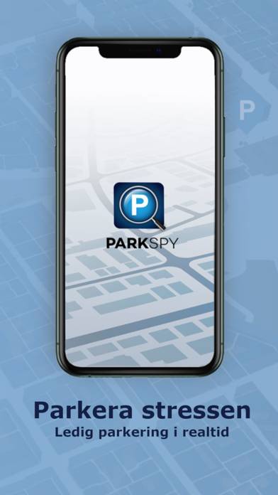
Parkspy