Theodolite

Published by Craig Hunter on Nov 30, 2009
Theodolite icon

Genre: Navigation

Ratings: 4.73

Version: 9.0.3

Updated: Sep 23, 2023

Downloads: 2,271

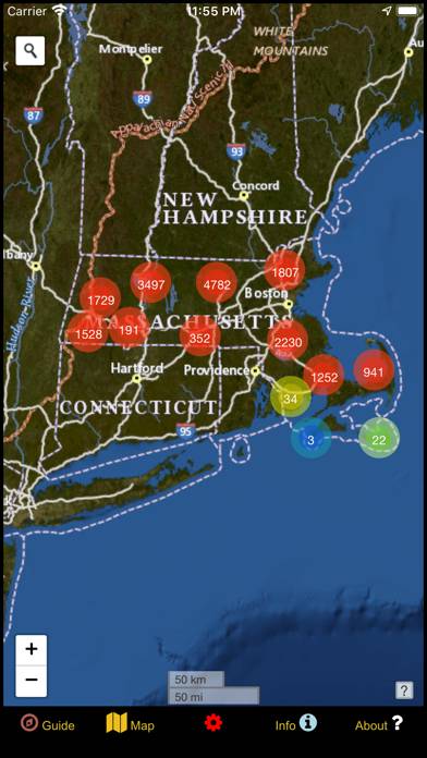
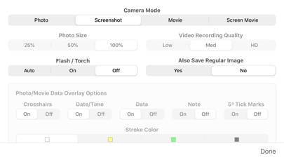
Theodolite is a navigation app developed by Craig Hunter. The last update, v9.00, released on September 23, 2023, and it’s rated 4.73 out of 5 based on the latest 850 reviews. Theodolite costs $8.99 and requires iOS 11.4+ and Android 10.4 or newer to download.

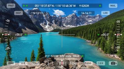
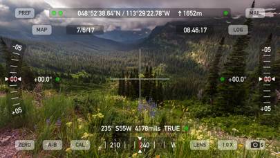
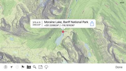
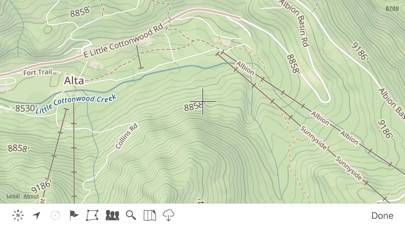
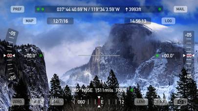
AR Navigation Viewfinder

Video: Theodolite Overview

Description

Theodolite is a multi-function viewfinder that combines a compass, two-axis inclinometer, rangefinder, GPS, map, nav calculator, and geo-overlay photo/movie camera into one indispensable app.
Show more

Available In-App Purchases

1,000 Outdoors Map Tiles

$0.99

10,000 Outdoors Map Tiles

$8.99

20,000 Outdoors Map Tiles

$17.99

5,000 Outdoors Map Tiles

$4.99

Team Tracking

$1.99

US Mountain Summits AR Layer

$2.99

Download Theodolite

Scan to Get the App!
QR code for Theodolite

How to Use Theodolite on Your PC or Mac

Want to enjoy Theodolite on your desktop? Download the latest APK (9.00, 30 MB) or choose your preferred version, and follow our Bluestacks emulator guide for easy installation on Windows or macOS. For any assistance with downloading or installing APK files, feel free to visit our forums!

User Reviews and Ratings

★★★★★ Better than I’d hoped for
Great app! With the extra peaks, it adds a great layer for fun.
★★★★★ Great set of apps
Really good. One question: is it possible to prevent app from hijacking audio? Found no way to use app while listening to audio (podcasts, music, etc).
★★★★★ iOS 17 problems fixed.
Update: 9.0.3 fixed the problem - impressive prompt response by the developer. Back to 5 stars. Still works under iOS 17 on 13 Pro Max, but strange display text overwriting artifacts make some of the data fields difficult to read.
★★★★★ Fantastic for Forensic Investigators
Use this at your site visits to document local coordinates and local level. Would be quite adequate for site photos. Predict sun position.
★★★★★ A great tool for documentation
Back when I worked disaster recovery for the State, I used this extensively to document damaged infrastructure (roads, bridges, water treatment plants, etc) damaged by natural disasters. We could document the exact location of damage and take after-photos to show the damage had been repaired.
Read all reviews

Related Apps

Cruise Nav screenshot
Cruise Nav
Top #60 in Navigation Apps
DC Metro and Bus screenshot
DC Metro and Bus
Top #97 in Navigation Apps
True Wind screenshot
True Wind
eMap JMU : James Madison University screenshot
eMap JMU : James Madison University
Top #96 in Navigation Apps
World Tides 2024 screenshot
World Tides 2024
Top #72 in Navigation Apps
Easy Charging Quality screenshot
Easy Charging Quality
Theodolite App Alternatives