TroutRoutes: Fly Fishing Maps is a navigation app developed by onXmaps. The last update, v5.00, released on September 16, 2024, and it’s rated 4.57 out of 5 based on the latest 3.5K reviews. TroutRoutes: Fly Fishing Maps is FREE and requires iOS 16.0+ and Android 15 or newer to download.
Find Access & Public Water
Video: TroutRoutes: Fly Fishing Maps Overview
Description
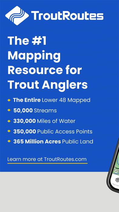
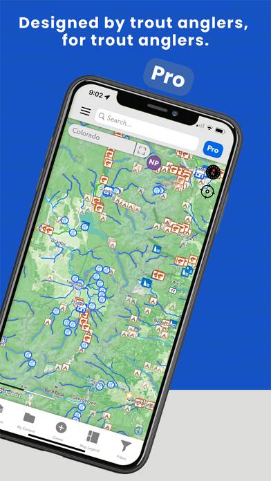
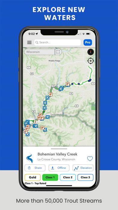
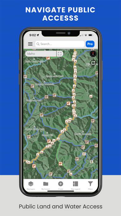
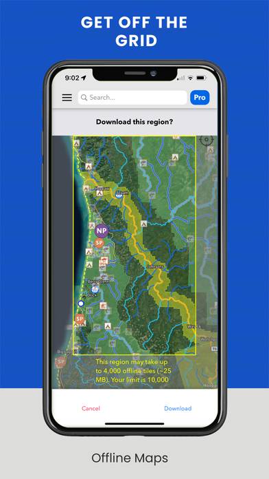
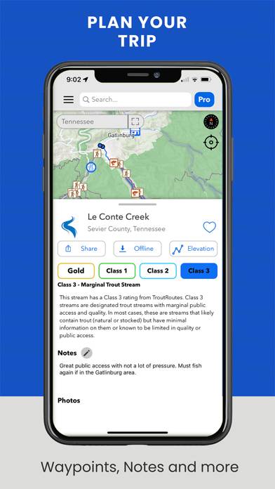
TroutRoutes is the #1 GPS mapping tool for trout streams and fly fishing. It is the industry's first mapping tool that includes interactive GPS fishing maps for every trout stream in the continental United States, providing comprehensive information for each stream and river.
How to Use TroutRoutes: Fly Fishing Maps on Your PC or Mac
Want to enjoy TroutRoutes: Fly Fishing Maps on your desktop? Download the latest APK (5.00, 235 MB) or choose your preferred version, and follow our Bluestacks emulator guide for easy installation on Windows or macOS. For any assistance with downloading or installing APK files, feel free to visit our forums!
User Reviews and Ratings
★★★★☆Hard to see icons
Something has changed and now you have to zoom in too far to even see a fly shop. I don’t like how small the icons have gotten.
★★★★★Super helpful
We are at a point that Class 1 plus waters are all we need. This app helps us find those and all the put ins and take outs we need
★★☆☆☆App locked up on stream, used OnX to navigate way.
First time I actually tried to use the app in a steam situation. App locked up and wouldn’t open past the blue screen. I just switched to OnX and used it the rest of the day. Now I’m not sure why I even purchased the Trout app. I had to restart the phone to get the app to work correctly once I was back in town. I also was surprised to find that the app doesn’t identify property lines and owners like OnX once I was able to work with it in town. Am I missing something?
★★★★★Great resource for avid fishermen
Great time-saving resource. Packed with information essential to planning successful outing near hom
★★★★★A must have
Absolutely love this app. I fish in Wisconsin’s driftless area where there’s limited cell service at times. That means no maps, etc to help orient to where you are. TroutRoutes must be satellite, tho I’m no tech kind of guy. No matter where I’m at, I can see in real time as I move upstream.
Then add in that they show parking, easements, even limits….as that changes from stream to stream.
I could go on and on. Suffice to say, TroutRoutes rocks! Thanks guys